
Mount Pinatubo Pictures, Images and Stock Photos
Browse 540+ mount pinatubo stock photos and images available, or search for mount pinatubo eruption to find more great stock photos and pictures.
Most popular
The crater of Mt. Pinatubo from the air in the Philippines

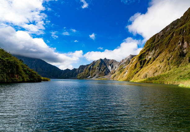
view of the crater lake of Mount Pinatubo volcano in Luzon, Philippines. The volcano erupted in July 1991, causing significant global environmental effects.

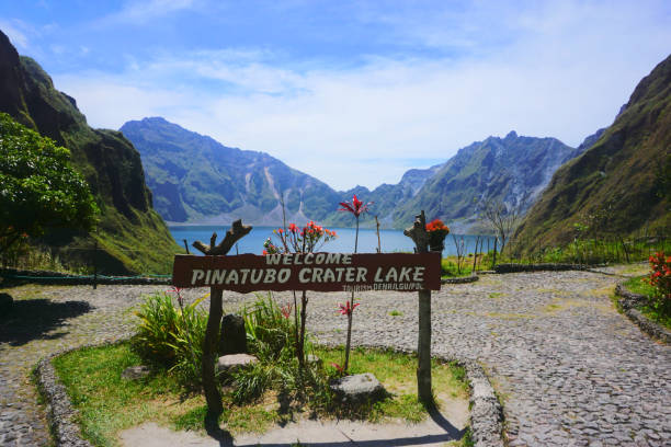
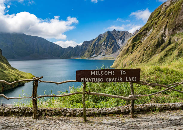
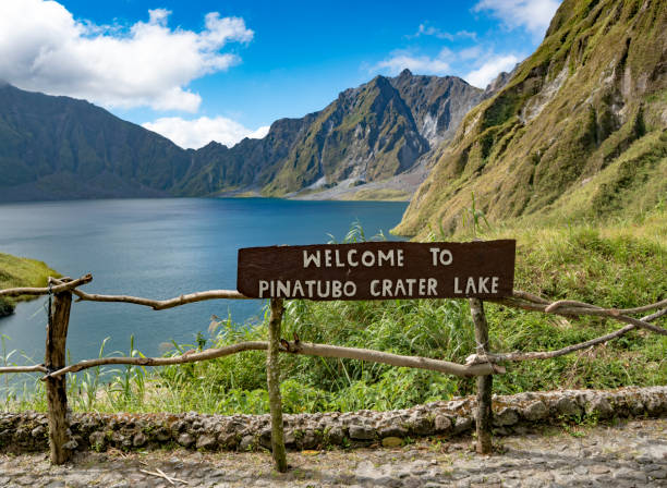
"Pinatubo crater lake, Philipines"

Elevated View of Crater Lake and Jagged Ridge of Mount Pinatubo (Volcano) - Luzon, Philippines

The crater of Mt. Pinatubo from the air in the Philippines

Overlook near crater of Mount Pinatubo, featuring a large lake in between towering peaks - Luzon, Philippines

The crater of Mt. Pinatubo from the air in the Philippines
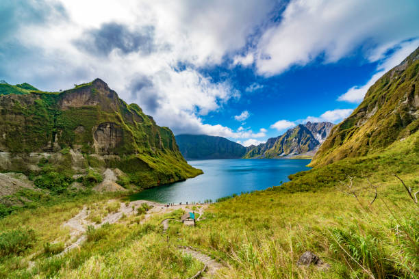
Pinatubo crater lake in Philippines
Philippines nature landmarks, travel places vector icons of volcanoes and mountain rivers. Philippines natural landmarks and national parks, Pinatubo, Mayon, Taal volcano and Chocolate hills

Beautiful sunset in Mt.Pinatubo, Philippines
Pinatubo crater lake in Philippines

landscape wie of the beautiful blue lake in volcano Pinatubo caldera, born after 1991 devastating eruption.
Pinatubo crater lake in Philippines

The crater of Mount Pinatubo in the Philippines. (People in photo not recognizable.)

Beautiful sunset in Pinatubo, Philippines


Sunset in Hawaii influenced by volcanic eruption of Mt. Pinatubo in 1991.

Mud volcanoes's clay river, closeup view

Lahar Volcanic Ashes That Dried Up Over a River

gravel road along the sand desert at the base of Pinatubo Volcano, result of the 1991 catastrophic eruption.

Pinatubo crater lake in Philippines

Pinatubo crater lake in Philippines

Mud volcanoes's clay river, closeup view

The Sulfur Lake of Pinatubo Volcano. Travel in Clark, Philippines in 2013, 21th July.

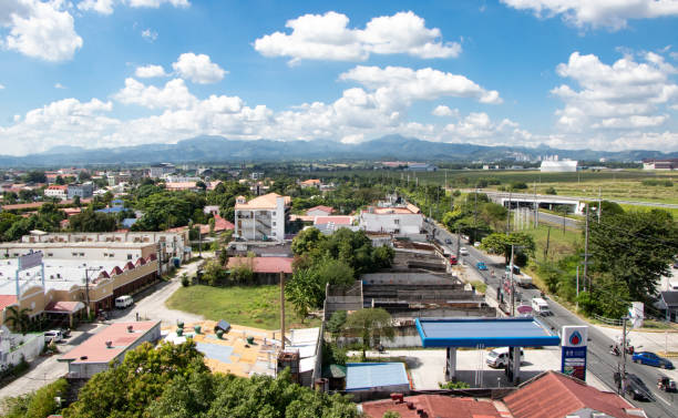
Aerial View of Angeles City / Clark, with the Zambales Mountains in the Distance - Angeles City, Pampanga, Luzon, Philippines

off road driving four wheel drives crow valley tour near mount pinatubo pampanga province the philippines
Pinatubo crater lake in Philippines

Beautiful landscape of blue lake, born after 1991 big eruption in the volcano Pinatubo caldera, Pampanga region - Luzon-Philippines

USA Hawaii O'ahu, sunset at Magic Island, Ala Moana Park. Extraordinary sky courtesy ash in stratosphere from Mount Pinatubo eruption in 1990.

Filipino children standing in a line and holding snack in their hands on Aug 27 2017 in Santa Juliana, Capas, Central Luzon, Philippines

3D Render of a Topographic Map of the Philippines. Version with Country Boundaries. All source data is in the public domain. Color texture: Made with Natural Earth. http://www.naturalearthdata.com/downloads/10m-raster-data/10m-cross-blend-hypso/ Relief texture: SRTM data courtesy of NASA JPL (2020). URL of source image: https://e4ftl01.cr.usgs.gov//DP133/SRTM/SRTMGL3.003/2000.02.11 Water texture: SRTM Water Body SWDB: https://dds.cr.usgs.gov/srtm/version2_1/SWBD/ Boundaries Level 0: Humanitarian Information Unit HIU, U.S. Department of State (database: LSIB) http://geonode.state.gov/layers/geonode%3ALSIB7a_Gen

The Sulfur Lake of Pinatubo Volcano. Travel in Clark, Philippines in 2013, 21th July.

Panoramic View of Crater Lake and Jagged Ridge of Mount Pinatubo (Volcano) - Luzon, Philippines

Soaking in the gorgeous view of all that Pinatubo and her crater lake have to offer in Luzon, Philippines.

Filipino children standing in a line and holding snack in their hands on Aug 27 2017 in Santa Juliana, Capas, Central Luzon, Philippines

Wide shot of the Zambales Mountains from the Sacobia River outside Clark, Pampanga, Luzon, Philippines
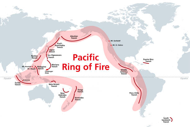
Pacific Ring of Fire, world map with oceanic trenches. The Rim of Fire, or also Circum-Pacific Belt. Region around the rim of the Pacific Ocean, where many volcanic eruptions and earthquakes occur.

volcanic landscape near mt pinatubo in northern luzon the philippines


Crater lake of the volcano Pinatubo among the mountains, Philippines, Luzon. Aerial view beautiful landscape at Pinatubo mountain crater lake. Travel concept

The Sulfur Lake of Pinatubo Volcano. Travel in Clark, Philippines in 2013, 21th July.

Horses in the field on the way to Pinatubo Volcano. Travel in Clark, Philippines in 2013, 21th July

landscape of beautiful blue lake in volcano Pinatubo caldera, born after 1991 devastating eruption.

shadows cast onto doorway of derelict building on clark air base pampanga the philippines, destroyed in eruption of mount pinatubo


The beautiful blue lake in volcano Pinatubo caldera, born after 1991 devastating eruption. Pampanga region - Luzon, Philippines Nikon

Blur in Car with the Big Rain and Storm on the way to Pinatubo Volcano. Travel in Clark, Philippines in 2013, 21th July.

Pinatubo crater lake in Philippines

The Sulfur Lake of Pinatubo Volcano. Travel in Clark, Philippines in 2013, 21th July.

cloudy sky at Mt Pinatubo, Capas, Philippines


Landscape view of the Sandy desert formed after the 1991 eruption at the base of Pinatubo Volcano, Pampanga region, Luzon - Philippines. Nikon

3D Render of a Topographic Map of the Philippines. All source data is in the public domain. Color texture: Made with Natural Earth. http://www.naturalearthdata.com/downloads/10m-raster-data/10m-cross-blend-hypso/ Relief texture: SRTM data courtesy of NASA JPL (2020). URL of source image: https://e4ftl01.cr.usgs.gov//DP133/SRTM/SRTMGL3.003/2000.02.11 Water texture: SRTM Water Body SWDB: https://dds.cr.usgs.gov/srtm/version2_1/SWBD/ Boundaries Level 0: Humanitarian Information Unit HIU, U.S. Department of State (database: LSIB) http://geonode.state.gov/layers/geonode%3ALSIB7a_Gen
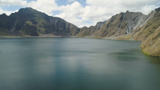
Crater lake of the volcano Pinatubo among the mountains, Philippines, Luzon. Aerial view beautiful landscape at Pinatubo mountain crater lake. Travel concept

beautiful landscape Mt. Pinatubo, Philippines
