Hiking the Via Alpina: Rossinière to Rochers de Naye

Overview

Hike from Rossinière over Col de Chaude to Rochers de Naye

[Rossinière (893m) – Col de Sonlomont (1501m)] – Vuichoude d’en Bas (1100m) – Col de Chaude (1621m) – Rochers de Naye (1974m)

This is a very hard hike on the Via Alpina and it takes about 8 hours to complete. It’s 23km long and brings you 1900 meters uphill and 820 meters downhill. You have to be in great shape as you are hiking over 2 passes and one peak. You will be rewarded with the most amazing view over lake Geneva and most likely shed some tears of luck.

+1900m -820m

8 hours

19km

Expert

Look back to Via Alpina hiking trail from Rochers-de-Naye, Switzerland
Last look back to Via Alpina hiking trail from Rochers-de-Naye

Our experience hiking on the Via Alpina from Rossinière/Allières to Rochers de Naye

Via hiked on the Via Alpina from Allières to Roches de Naye in July 2020. On this hike we were pretty nostalgic as it was our last leg on the Via Alpina. On it, we ate the most amazing cheese plate on the Via Alpina and set the sun over lake Geneva. As we were pretty tired at this stage we took a shortcut and we will share the route with you in this post. Read more about our hike on Via Alpina to Rochers de Naye below.

From Rossinière to Rochers de Naye: hike smart, not hard

We celebrated the upcoming last hike on the Via Alpina with a fine dining extravaganza in restaurant les Jardins de la Tour in Rossinière. We talked about the the final leg over the meal. The original route from Rossinière leads over two passes: pass Col de Sonlomont and pass Col de Chaude – and then ascends to Rochers de Naye. As we were really tired we decided to skip the first pass, take the train to Allières and start the hike from there. Doing so saved us 1000 vertical meters.

Profile picture of Solène Stucker, co-founder of Hike&Dine
Solène’s Dine Pairing

Dine at Restaurant les Jardins de la Tour in Rossinière

“From the moment we set foot in Patrick Gazeau’s restaurant in Rossinière, I felt enchanted. The chef himself creates all the dishes. The herbs and flowers are from his garden. Every course looks like a painting and tastes like heaven on earth.” 

Col de Chaude and Rochers de Naye: One pass and one peak are though enough

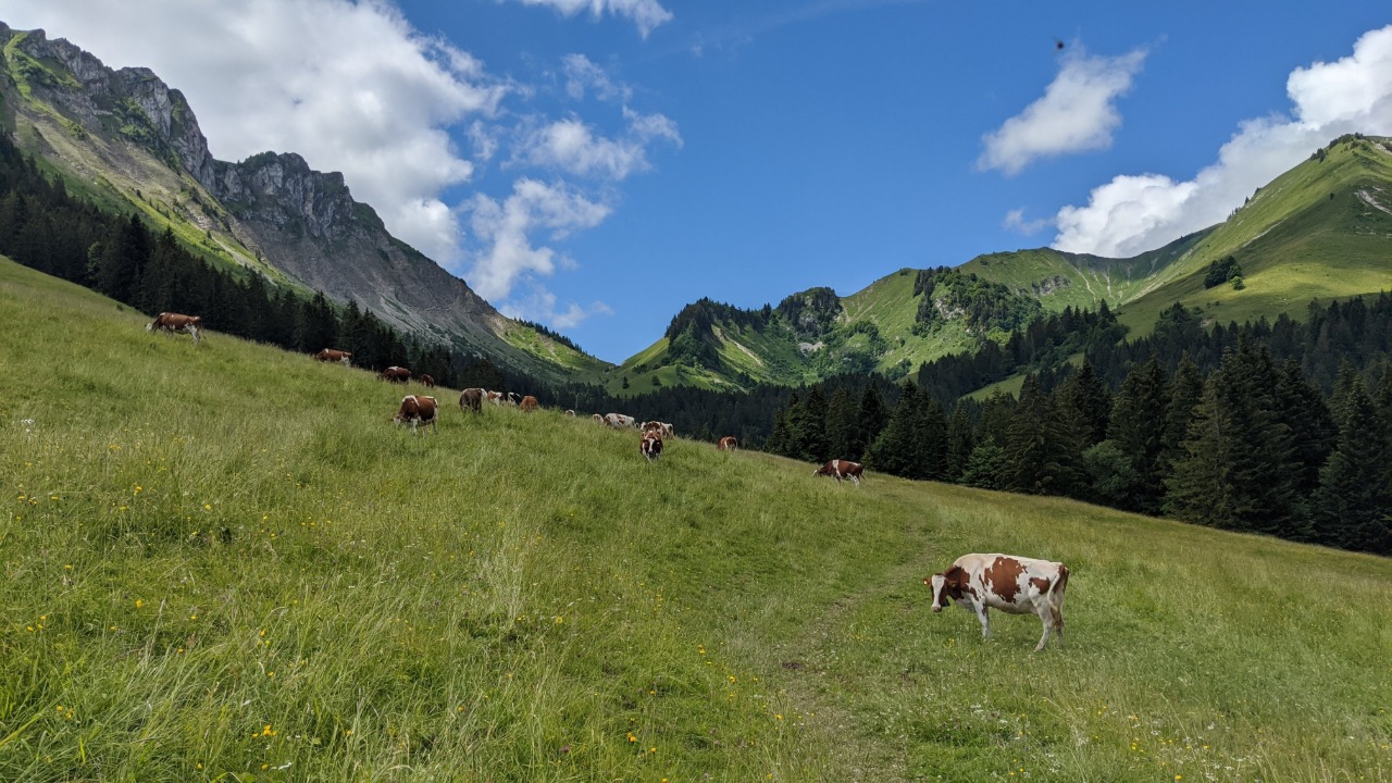
From Allières it took us 1.5 hours on a paved road to get to Vuichoude d’en Bas where we reached the official Via Alpina hiking trail. Oh boy, were we relieved that we skipped pass Col de Sonlomont when we saw it. Motivated, we hiked uphill through a forrest and arrived at la Vuichoude d’en Haut. Cows ahead!

Cows on a green field on the hike on Via Alpina to Rochers-de-Naye, Switzerland
Cows on a green field on our hike to Rochers-de-Naye

Turning back, we could see the beautiful Lac de l’Hongrin. We realised that another route to Vuichoude d’en Bas would be to start in La Lécherette. Next time.

Solène climbing over a ladder on the hiking trail to Rochers-de-Naye
Solène climbing over the last obstacle before arriving on Rochers-de-Naye

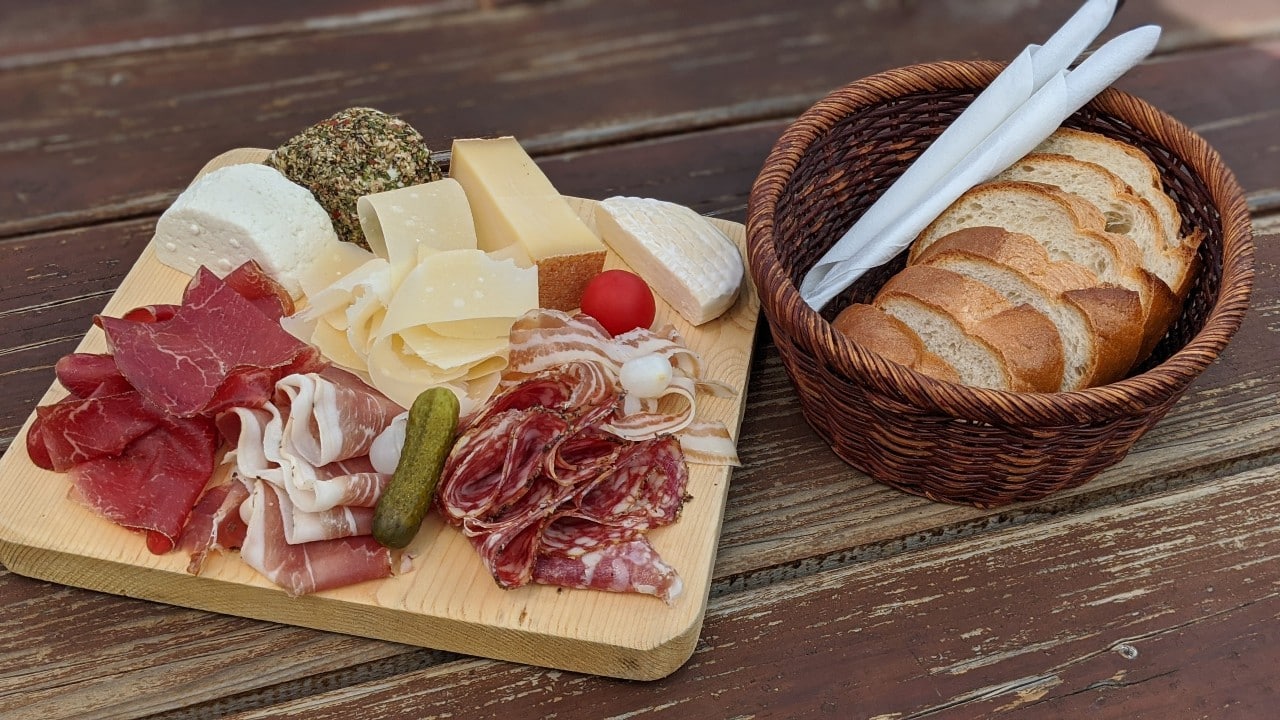
Cheese, please: the best cheese plate on the Via Alpina

Another forrest and I suddenly was very hungry. Et voilà, there was another farm just around the corner – we expected nothing less from the French part of Switzerland! We sat down and ordered a cheese plate. It was probably the biggest cheese plate we’ve ever seen and it was gone in no time. Cheese lovers watch out: you absolutely have to stop there. The farmers produce a local cheese called “le petit chaude” and it’s absolutely mind blowing. I could write a whole chapter about it but not a word would honor the taste of this delicious creation enough.

Cheeseplate we ate on Via Alpina in Chalet du Col de Chaude
Most likely the best cheeseplate in the universe but for sure the best on Via Alpina

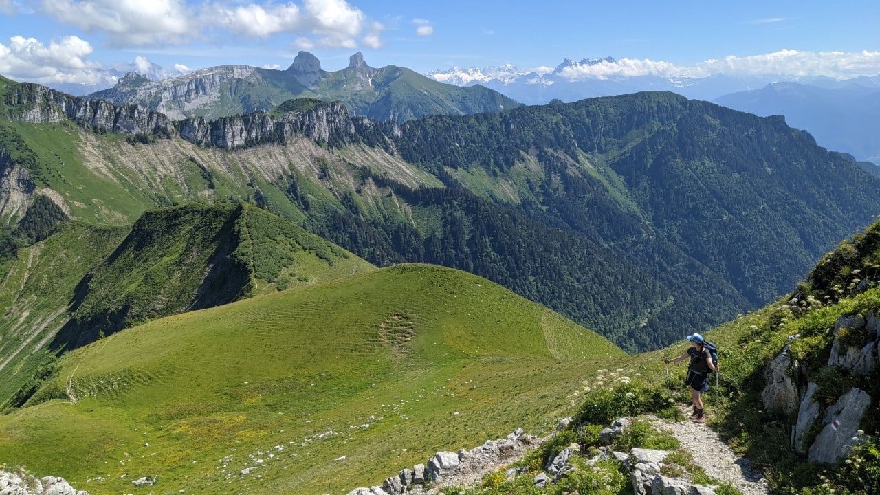
Col de Chaude and a walk on a ridge

It was a very hot day and we were truly exhausted – but we knew the goal was near. From Col de Chaude a trail tooks us uphill onto a ridge. From there we got great views back to L’Etivaz and even Gstaad (where we came from).

Solène looking back to Via Alpina from Rochers-de-Naye mountain. In the background lac de Hongrain and views to Col de Jable mountain pass.
Solène looking back to where we came from. Via Alpina, July 2020.
Solène and Matthias taking a selfie on Rochers-de-Naye mountain. In the background lake Geneva.
Happy on Rochers-de-Naye after 16 days hiking on the Via Alpina

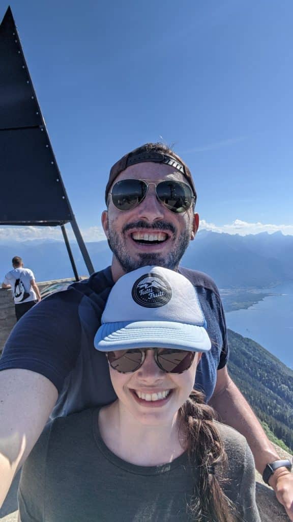
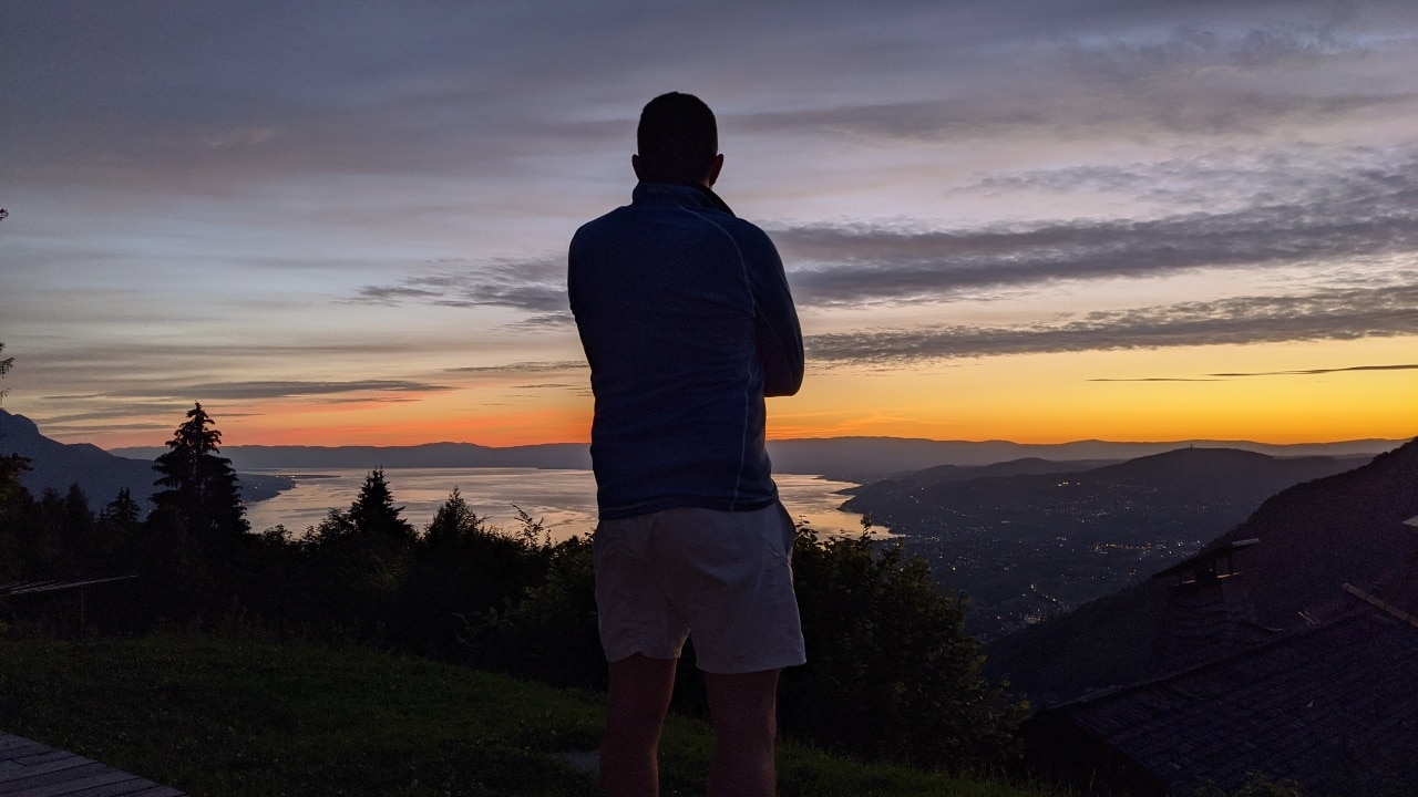
A well deserved view over lake Geneva from Rochers de Naye

With every step we realised that the goal of the 16 days hiking on the Via Alpina came closer. Happy and also a bit sad, we took the last steps up to the peak of Rochers de Naye. Never before lake Geneva looked so beautiful. What a view – and what an adventure. 130km from Meiringen to Montreux – we made it!

Matthias Solène on Rochers-de-Naye in Switzerland. In the background lake Geneva.
After 130km hiking from Meiringen we made it to Rochers-de-Naye
Hike&Dine Tip

Hiking Philosophy

If you want to extend the “we made it”-feeling after hiking the Via Alpina, spend a night at the Hotel Le Coucou in Caux above Montreux. From Rochers de Naye take the cable car to Caux. The rooms are solid and the food is good. But this place is about the view! From the hotels’ terrace you’ll have the most spectacular view over lake Geneva. The sunset was one of the best we’ve ever seen in Switzerland. After dinner we chilled out in the sunchairs and enjoyed a sundowner par excellence. Bonne nuit!

Matthias on the terrace of restaurant le Coucou above Montreux. In the background the sunset over lake Geneva.
Matthias setting the sun over lake Geneva after 16 days hiking on Via Alpina
Practical Information

Prepare your hike on the Via Alpina from Rossinière/Allières to Rochers de Naye

Get to Rossinière/Allières by train from anywhere in Switzerland. Look up trains and cable cars directly on the site of Swiss National Railway (SBB) by typing in the starting point and Rossinière/Allières as the destination.

This hike is though and only suited for expert hikers. It is often very steep. You must be in good shape and be able to walk for 8 hours plus.

On the site of SwitzerlandMobility you can download an altitude profile and find a map of the hike.

The Via Alpina starts in Rossinière and ends on mount Rochers de Naye. This means +1900m up and -820m down. More infos on the trail can be found here.

Bring enough snacks and water as you won’t be able to refill it on the way.

Take it easy! We started in Allières to shorten the hike and recommend you do the same if you are not an athlete.
Take the train from Rossinière or Chateaux d’Oex to get to Allières.

Alternatively start in La Lécherette and walk along Lac de l’Hongrin. Take the bus from Chateau-d’Oex to get there (timetable).

Lac de l’Hongrin is a military zone and looks like the secret hideout of a villain in a James Bonde movie. There might be waiting times if you go by car.

Scroll to Top