Barrage de la Grande Dixence from Sion
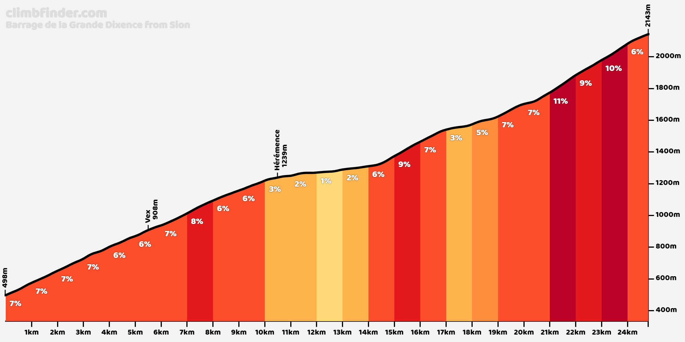
Barrage de la Grande Dixence from Sion is a climb in the region Valais. It is 24.9km long and bridges 1645 vertical meters with an average gradient of 6.6%, resulting in a difficulty score of 1280. The top of the ascent is located at 2143 meters above sea level. Climbfinder users shared 2 reviews of this climb and uploaded 7 photos.
Road names: Route d'Hérens, Route de Sion, Route d'Hérémence, Rue Principale, Les Coquelicots, Prolin, Tsaumetta, Rafô & Le Chargeur
5.0 by gaugau7This is an automatic translation, the original language is: French.A must-see climb in the Valais! A very long climb, during which it goes up without stopping for almost 25 km! The road is in very good condition throughout the climb, with very little traffic. The highest gradients are in the last part of the climb, where there are many tight switchbacks. Once at t... read more
Photos (7)


If you want to upload your photos, you need to create an account. It only takes 1 minute and it's completely free.
- Add photos of your conquered climbs.
- Share your experience on all ascents you've climbed
- Submit your favorite climbs
Statistics
| Barrage de la Grande Dixence from Sion This climb |
Valais 119 climbs | Swiss Alps 626 climbs | Switzerland 793 climbs | Alps 4974 climbs | Europe 43118 climbs |
|---|---|---|---|---|---|
|
1280
|
rank
11
|
rank
32
|
rank
32
|
rank
186
|
rank
282
|
|
Average gradient
6.6%
|
rank
87
|
rank
431
|
rank
519
|
rank
2755
|
rank
11806
|
|
Length
24.9km
|
rank
9
|
rank
21
|
rank
21
|
rank
128
|
rank
429
|
|
Total ascent
1645m
|
rank
8
|
rank
10
|
rank
10
|
rank
58
|
rank
127
|
Classification
Road surface condition
Traffic
Climbing times
| 7 km/h | 03:33:13 |
| 11 km/h | 02:15:41 |
| 15 km/h | 01:39:30 |
| 19 km/h | 01:18:33 |
Popular


Reviews (2)

A must-see climb in the Valais!
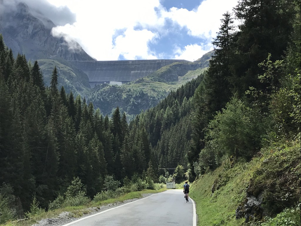
A very long climb, during which it goes up without stopping for almost 25 km! The road is in very good condition throughout the climb, with very little traffic. The highest gradients are in the last part of the climb, where there are many tight switchbacks. Once at the top, it's worth having a lock (walking shoes) to take the path to the top of the dam, almost 300 metres higher (a cable car for this last leg is also available)
Montée incontournable du Valais !
Très longue ascension, durant laquelle ça monte sans arrêt durant presque 25 km ! La route est en très bon état tout au long de la montée, avec très peu de trafic. Les pourcentages les plus élevés sont dans la dernière partie de l'ascension, où se succèdent de nombreux lacets très serrés. Une fois en haut, cela vaut la peine d'avoir un cadenas (des chaussures de marche) pour prendre le sentier jusqu'au sommet du barrage, presque 300 mètres plus haut (un téléphérique pour cette dernière étape est aussi accessible)

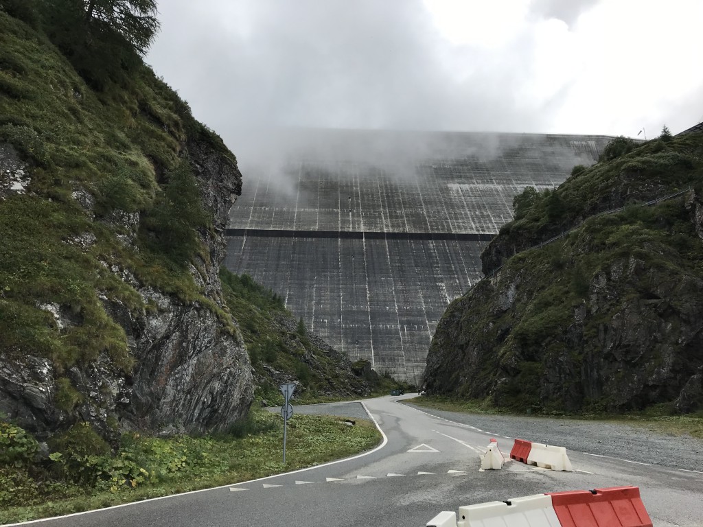
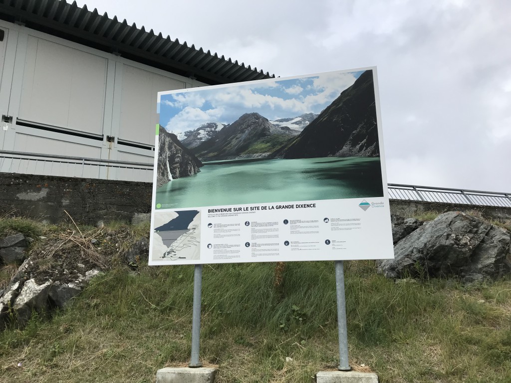
Beautiful road to the largest reservoir in Europe.
The dam is 285 meters high and provides twenty percent of Switzerland's energy supply.
Last part of the climb 13 hairpin bends with steep percentage between 10 and 12%.
Prachtige weg naar het grootste stuwmeer van Europa.
De dam is 285 meter hoog en verzorgt twintig procent van de energievoorziening van Zwitserland.
Laatste deel van de klim 13 haarspeldbochten met pittige percentage tussen de 10 en 12%.